
Adventure: Trails in Zahara de la Sierra, Cadiz
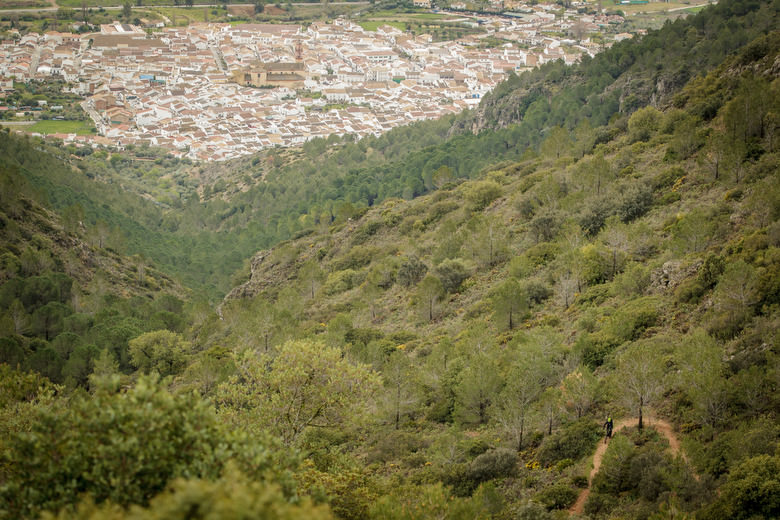
The Sierra de Grazalema mountains break up the Andalusian countryside plains with its imposing limestone massif. Its crags stand as a natural wall to the Atlantic winds, filled with humidity, making it the most rainy area in the southern half of the Iberian peninsula. On top of rocks lies the white walls of Zahara, standing in contrast to the dark scrubs clinging onto the steep face of the mountain.
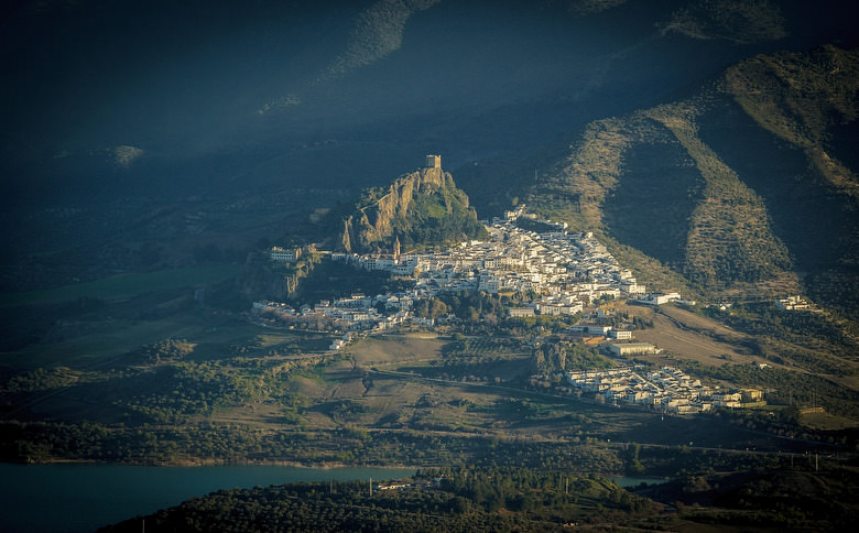
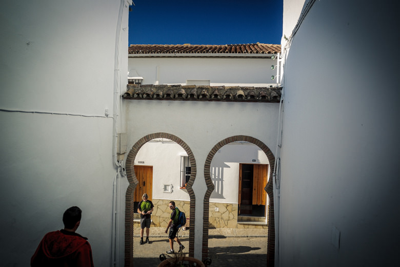
Coloured in the typical white of the Andalusian White Village, Zahara seems to stare at us hanging from a rock. the Ancient Moorish fortress watches from above over the El Gastor dam. From the car number plates it looks like we are in Brussels during an European summit, Germans, French and British have all come to discover the hidden Spain.
As we try and reach downtown with our van (urban habit) the steep gradient convinces us to instead start walking by the castle tower, the distance is short but hard to climb, is this an omen? Now we see why the Ibex is one of the most representative animals of the local fauna.
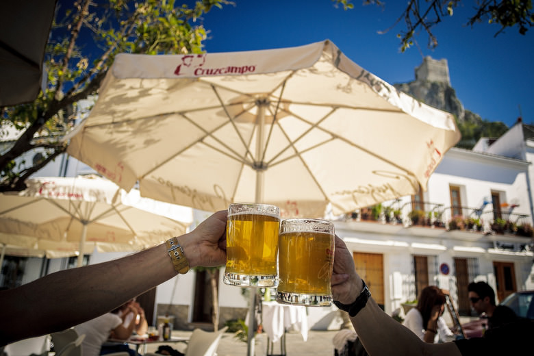
We get lost in the charming lit streets searching for some beers, in Al-agua’s bar terrace a Moroccan waitress with a strong local accent wonders if we speak Spanish, for a moment it looks like we have jumped back centuries as we laugh. For only 30 EUR, 3 people have 5 dishes packed with Spanish specialties, cold beer, cakes and coffee.
At first sight, with only a GPX track in our pocket, one that looks more like a digital patchwork sewed by the expertise of our guide Jorge Talus than a real MTB tour, Monte Prieto’s hillside that we intend to ride looks crazy. We came blind. The excitement of the adventure keeping us from sleep. Will it be possible to descend over that face? Will it be rideable? As the sun goes down to an ancient chant sounding over the hills, like a call to prepare our mounts, we ready our weapons.
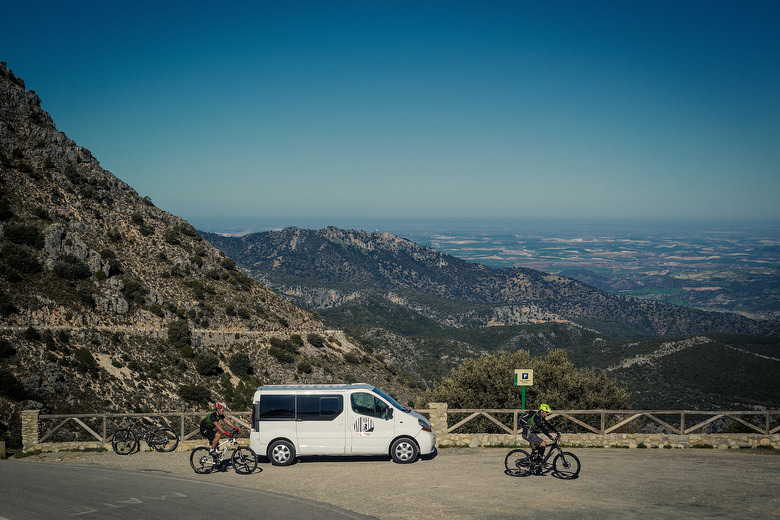
The sign at Puerto de Las Palomas (Pigeon pass) shows 1375m, our GPS (more reliable) 1189. We travelled here from Zahara, mase easier with an uplift. Our goal is to travel back to El Gastor dam across one of Monte Prieto’s faces. We studied three variants but chose to ride the highest trail on the west face that looks very flowing up and down.
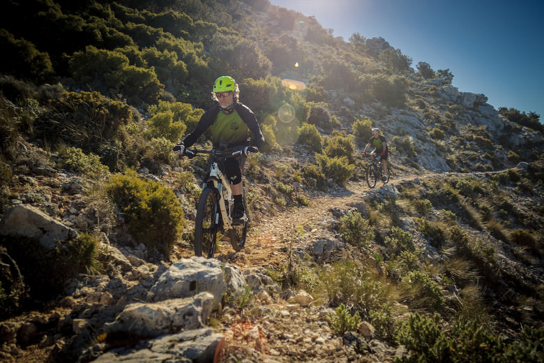
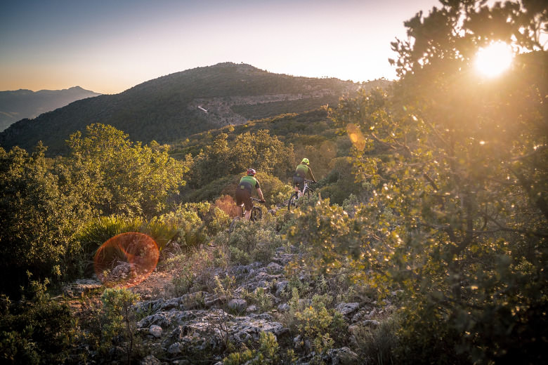
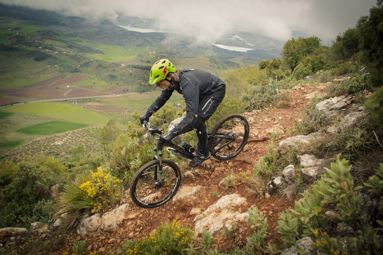
The trail is ribbon of red dirt over limestone, narrow and with rocks lining the edge like a warning of a dangerous fall, one mistake would take us to a landing where thorns would become our best friends. Even so it’s fast and technical, making us enjoy the possibility of riding across an unequaled landscape. With the Exception of some small passes without traction, and some steps we can pedal most of the trail, only the views make us stop.
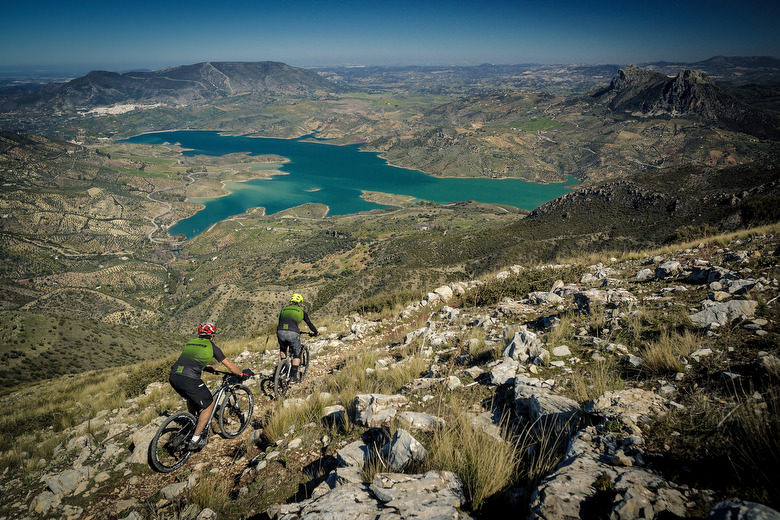
As we flow over Zahara-El Gastor dam, it’s like a turquoise blanket over the brown dirt. Created in 1995 to irrigate the Villamartin countryside, it flooded part of the Royal cattle route Seville-Ronda and the Ventas Nuevas salt mines, only the medieval bridge that was dismounted and moved was saved from the waters.
The flow ends on steep switchbacks where we have to stay focused, farther on there are sections where we’ll be able to release our brakes and feel the adrenaline flow. In some parts it’s so open that unconsciously we get closer than we should to the edge.
We reach a small pass from where we can see both the faces of Monte Prieto. Here’s a technical section where we need to dismount due to a big fall, we would have been forced to dismount anyway later, due to a tight switchback that links to other section that leads to Los Espartales rocks.
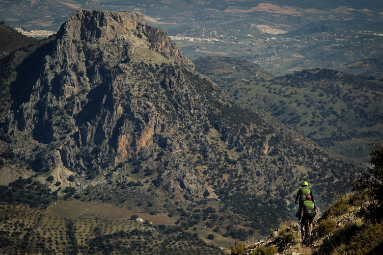
Looking north we can see the peaks of Tajo las Grajas (left) and Tajo Algarin (right) between which passes the border that divides Cadiz and Malaga. In the background we see the table of old Ronda that holds the roman ruins of Acinipo and to the south east Libar range, that hides Ronda.
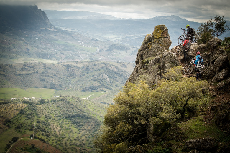
Here the easterly wind blows hard and we need to exercise caution as we wind through exposed areas. We enter a gorgeous trail that ends in an olive tree field. As we reach Los Espartales rocks we dismount again and see vultures flying over our heads, it’s a reminder that, in places like this, mistakes are expensive. In Grazalema lives one of the most important vulture colonies in Europe. They fly so low that we get a hint of their size and huge wingspan.
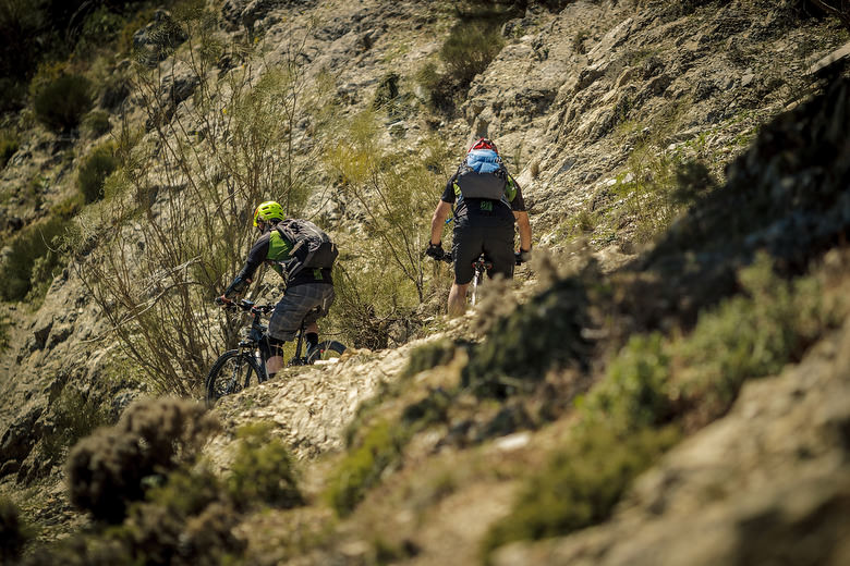
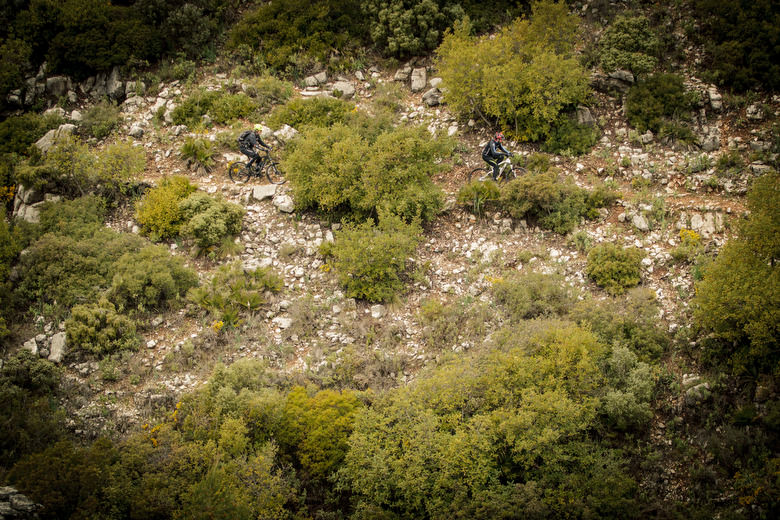
As we keep riding the trail starts to vanish, just a few people pass through here. We keep going and we feel like entering into a book of tales. One pro of riding a non crowded trail is finding no one as we go, howeveer, we do encounter many challenging thorn bushes that claim scratches on our arms and legs. It’s highly recommended to have good tires and carry spare tubes, patches, etc. The trail is precipitous and besides cutting rocks there are sections with many types of thorn bushes.
As we reach the end of the trail we come to the turquoise again, a healing splash will mend our scratches, and floating in the waters of El Gastor dam we look up those walls that looked impossible when we arrived. Now they stand as trophies.
More information on www.trackmtb.com
Words & Pictures: www.trackmtb.com
Did you enjoy this article? If so, we would be stoked if you decide to support us with a monthly contribution. By becoming a supporter of ENDURO, you will help secure a sustainable future for high-quality mountain bike journalism. Click here to learn more.