Adventure: Two months on the roof of the world in Nepal

As a guide for Asia Guide Adventures, Taner Yalcin spent the past autumn crisscrossing the Himalayas, encountering cyclones, snowstorms and breathtaking trails. Read it here.
The start of October marked the beginning once again, time for the annual autumnal tours of the Himalayas. This year I had three pre-booked tours on the Annapurna circuit ahead of me. After ensuring my goat and sufficient equipment for my two-month long Nepalese adventure were safely packed and stowed away, I set off from Bangkok in the direction of Kathmandu.
But I was completely unaware of what surprises were laying in store for me on this year’s trips.
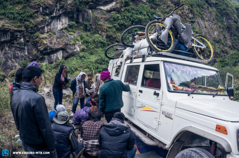
After a week in Kathmandu organising the logistics and the permits, the year’s first guests from Germany arrived and we left Kathmandu behind us, heading with the porters towards Besisahar (1,000m). Eight hours of driving later, we reached our chosen base camp, the departure point for our Annapurna circuit.
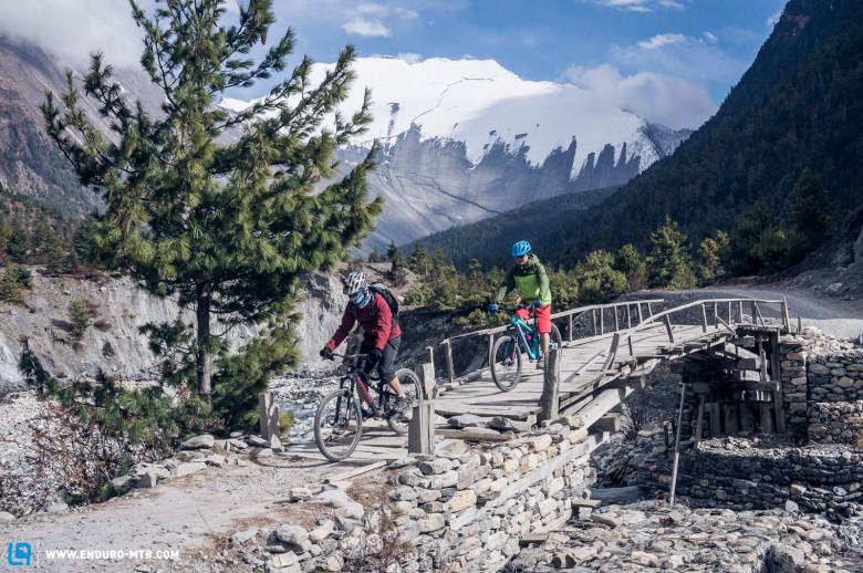
On the first day of our trip we traversed through subtropical flora and fauna, with the 8,125 metre high Manaslu in our sights. The landscape underwent a gradual change as it became more and more Alpine-like. The culture changed too; from the predominantly Hindu culture and lifestyle of Besisahar from where we’d set off on bikes three days earlier, we were now in the midst of Tibetan-Buddhist cultural area once again after climbing a significant height and clambering over landslides.
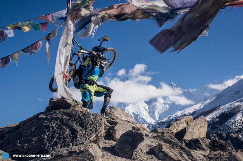
Eventually we reach our lodge in Pisang at 3,200m, directly facing the veritable giant of the Himalayas, the Annapurna II (7,937m). It begins to rain as we leave the early evening prayer at the Tibetan Buddhist temple. Then, once the sun goes down, said rain turns to snow. That this turn of events could mark the beginning of the end of our bike trip evades us – and we are unaware that the snow that was slowly setting in heralded the entrance of Cyclone Hudhud, a storm that would devastate the region of Annapurna.
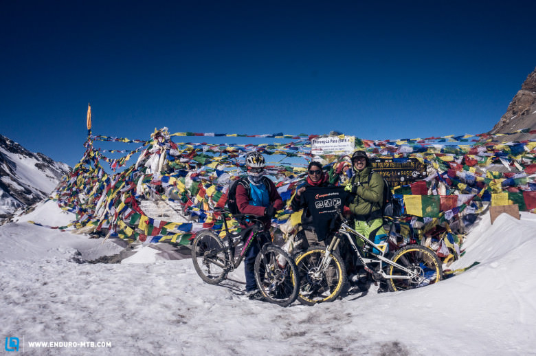
The following morning, with everything blanketed in around 40cm of snow, a rethink was necessary; we wouldn’t be getting further on our bikes. Despite the snow, we decided to continue on foot in the direction of Manang (3,540), hoping to at least stick vaguely to the trip’s schedule. We were completely oblivious to how it actually looked further up! At this point in time, we were unaware that it had been an extraordinarily strong cyclone, depositing the greatest amount of snow on the region in more than 20 years for this time of year. Along with some of our porters, the bikes stayed in Pisang, while we went on foot through the snowfall. Upon arriving in Manang (3,540m), we heard that some hikers on the Thorong La pass and other areas in the region had died in avalanches – and these were places we’d planned on going with the bikes. After two days in Manang, the snow subsided, but we still didn’t know what had happened – or even that we couldn’t continue on foot. Lots of hikers and other riders were snowed in thanks to the mass that had fallen, and the few lodges around were crammed with guests, along with their guides and porters.
And with this the first tour literally fell into the snow. Instead of riding, we went out on as many hiking expeditions as we could. Once the avalanches had subsided, we set off on foot, following the same route down. Eventually we made it back to where we’d initially started, Besisahar, all feeling a little subdued given what had happened but also incredibly happy not to have been further up the Annapurna circuit or on the Thorong La pass during Cyclone Hudhud. After the arduous hike through the snow we decided to go to Pokhara to relax.
Once my guests returned home to Germany after appreciating several relaxing days in Pokhara and Kathmandu, the next bunch of guests arrived, awaiting the second tour of the Annapurna circuit – this time from Thailand and Malaysia. Yet again we set off from Kathmandu towards Besisahar.
In the meantime it had become common knowledge that Cyclone Hudhud had cost the lives of dozens of hikers in the Annapurna region. Now over two and a half weeks ago, the snow-covered Thorong La pass (5,416m) had once again become passable. As my Asian guests were more limited for time, we planned to go by jeep from Besisahar (1,000m, the regular starting location) to Chame (2,650m) and then to ride from there.
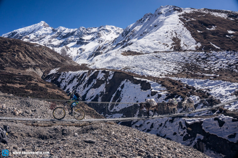
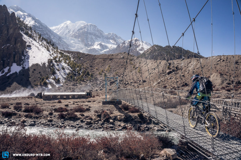
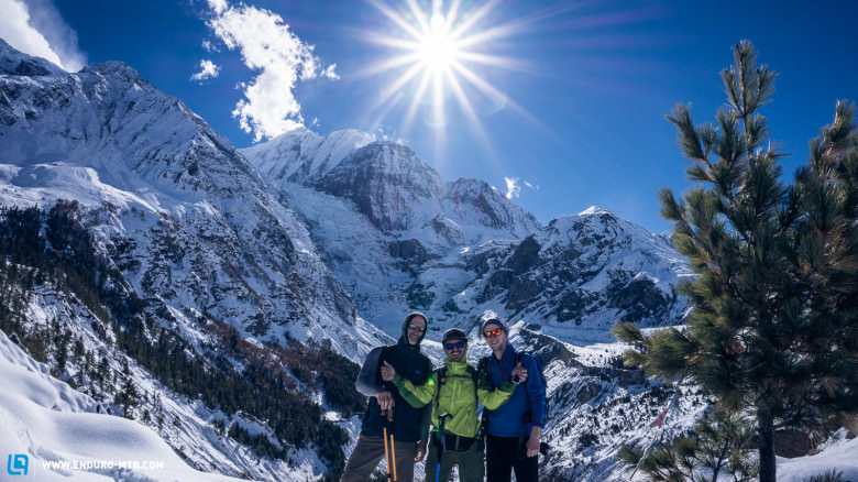
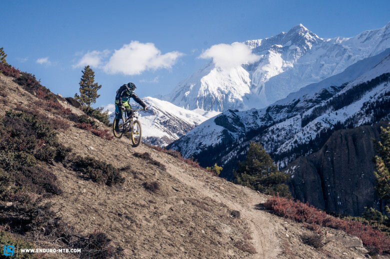
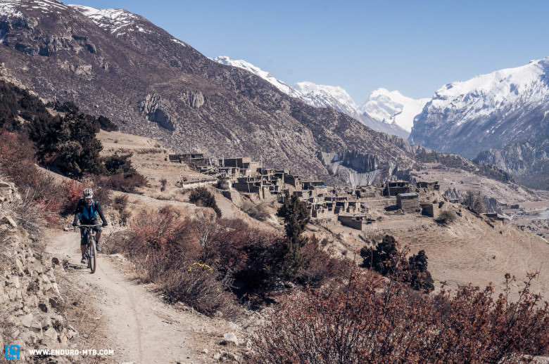
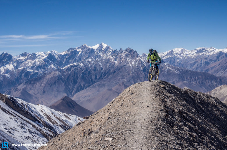
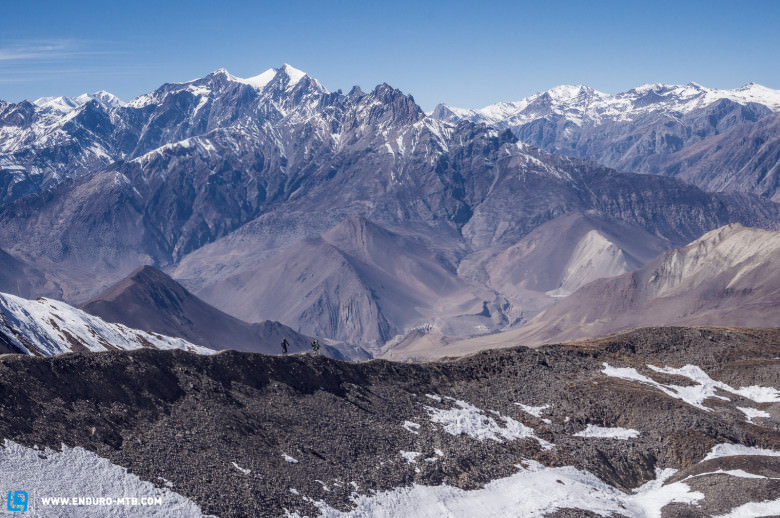
To our delight, we were able to ride from Chame to Pisang and from there to Manang, as the snow had cleared from the sunny sections of the trails and this made them more than rideable. It was all going well at this point and my guests were satisfied with their form on the bike. We then had to spend a few days in Manang (3,540m) in order to acclimatise our bodies for the upcoming altitudes. We did some acclimatising rides, heading up over 4,000m and enjoying the view over the snow-covered Himalayan giants, Annapurna III (7,550m), Gangpurna (7,450m) and countless other summits in the area.
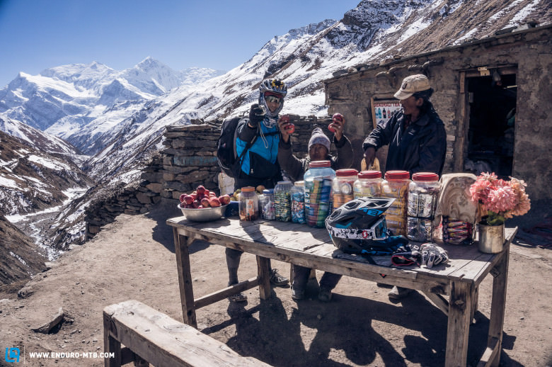
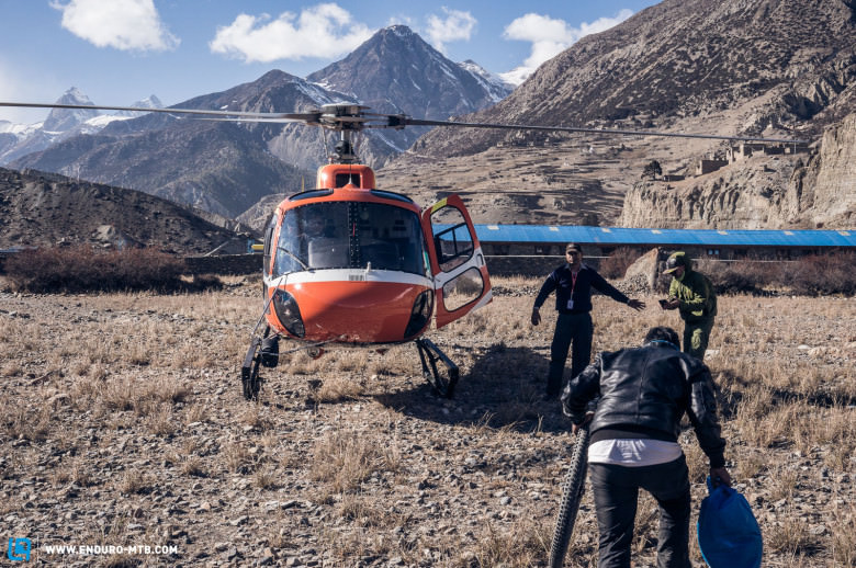
The third morning in Manang heralded our departure on bikes for Yak-Kharka (4,150m), but Kent, a guest from Thailand, was not feeling too good, showing slight symptoms of altitude sickness. Wisely deciding to stay in Manang for another day, I took Kent to the small medical practice led by the Himalayan Rescue Association, which is run by foreign doctors during the high season of October until the end of November to treat hikers and locals with altitude sickness and other issues. The diagnosis didn’t take long, and hearing that he had only 60% oxygen content came as a blow to Kent. After three days of good acclimatising at this altitude, the figure should hover around at least 75-80%. Moreover, they diagnosed a slight pulmonary oedema, a case of fluid collecting in the lungs. As this marked the end of Kent’s trip, I organised a helicopter and he flew to hospital in Kathmandu with one of my fellow Nepalese guides.
Having first encountered the devastating cyclone, this was the second surprise that was sprung on me during this year’s tours.
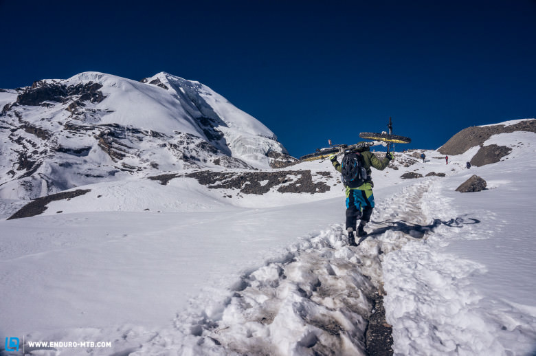
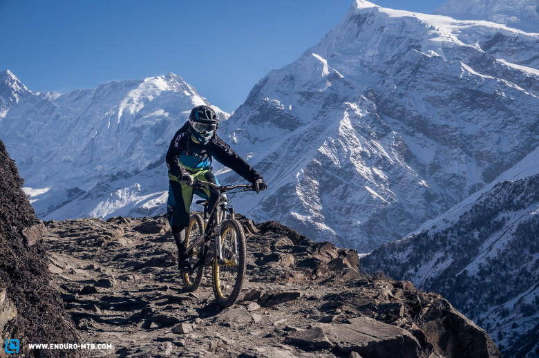
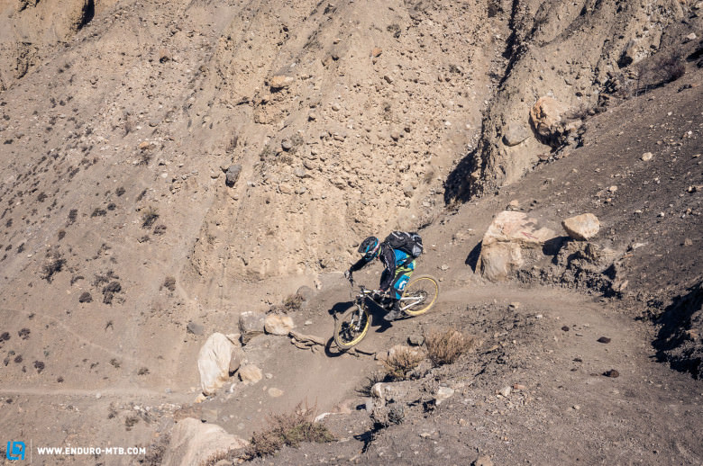
As Stanley, my guest from Kuala Lumpur, still felt in great condition, we set off the next morning at sunrise to Yak-Kharka (4,150m) with the intention of riding to Thorong Pedi (4,550m) the following day. The normal scene is as follows: this would be the place from which we’d depart at 3am, carrying the bike on foot up to Thorong-High-Camp (4,950m), we’d then enjoy a tea break before riding for around eight hours up to the highest point of the tour, and riding over the Thorong La pass at 5,416m. Yet this occasion was different; once we started climbing from Thorong Pedi to High Camp we couldn’t fail to notice that the pass was knee-deep in snow from Cyclone Hudhud. This then demanded eight hours of lugging the bike on our shoulders, with just a few rideable sections on the snow. But we still had fun! Hours later, we finally reached Muktinath (3,800m) in the former Kingdom of Mustang, and from here there was about 40% of the snowy descent that was great to ride in. Entering that night’s lodge, we were overjoyed and after a warm shower, the grins were permanently fixed on our faces.
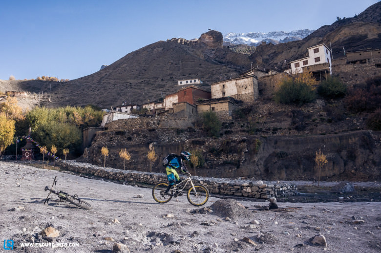
The following day brought with it an amazing descent on the circuit’s best trails. After a small climb to 4,000m, we enjoyed the long descent through the Lupra valley with its sandstone formations to Jomsom (2,700m). During the ride we had to keep stopping in awe at the sight of the 8,000m Dhaulaghiri massif and other ice giants in the mystical, almost steppe-like Mustang Valley. Having already completed this route as a hiker the previous year, my guest had requested a mountain flight from Jomson (2,700m) to Pkhara (860m) with a small propeller plane. This saved us a day of riding on a super dusty double track trail, with constant jeeps and buses passing by. Once in Pokhara we heard that our friend Kent was already back in Bangkok after two days in hospital. And this is how yet another adventurous bike tour on the Annapurna Circuit came to its conclusion.
After recharging in Pokhara for a few days, I began my final tour with four guests from Germany – one that fortunately passed by without any major incidents. With two eventful and exciting months in Nepal now behind me, the autumn season was over and I could return to Bangkok.
More information on www.facebook.com/looseriders and www.asiaguideadventures.com
Words & Pictures:Taner Yalcin, asiaguideadventures.com
Did you enjoy this article? If so, we would be stoked if you decide to support us with a monthly contribution. By becoming a supporter of ENDURO, you will help secure a sustainable future for high-quality mountain bike journalism. Click here to learn more.