Local Heroes: Winter in La Palma

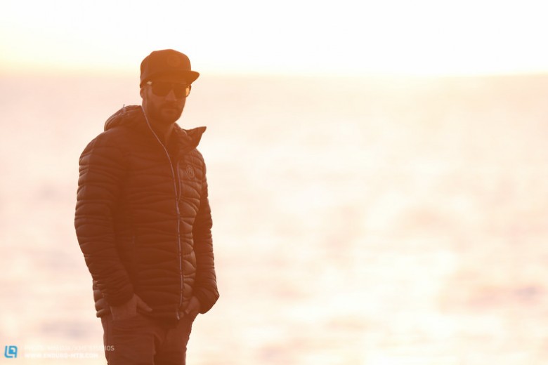
Holiday homes on a luxury island, getting away from work and the everyday life of what you’re used to may seem like the ultimate daydream for the non-mountainbikers of this world, but for us, Daniel Schäfer lives his winter season in what we’d class as heaven. Check it out in Issue #016 of the magazine, or read on for the full story.
Sometimes, as I’m lying on the beach, my thoughts drift back to the winters I used to spend in chilly Germany. These days, Christmas and New Year’s are spent in board shorts, and throughout January I’m treated to fresh oranges and avocados from my neighbour’s tree. It might sound like a farflung tropical paradise – but it’s only four hours from good old Germany.
At the same latitude as Morocco, Spanishspeaking, and with a definite Cuban influence, you’ll find seven Canary Islands, and La Palma is one these. The language came with the arrival of the Spanish, who landed on the islands to stake their claim before leaving years later. But they didn’t immediately return to the mainland or to Africa – instead they went straight to the source of the trade boats, which left South America laden with sugar, coffee ,and other goods. Naturally, many of them returned, and that’s why the Buena Vista Social Club is as common as salsa and merengue. Cigarettes, bananas, architectural styles, and lots of food products were also imported from South America.
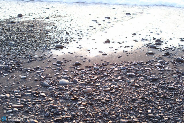
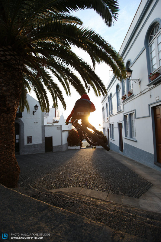
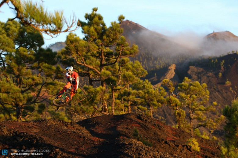
Just off the west coast of Africa in the Atlantic Ocean, La Palma stole my heart. Despite its tumultuous history, it has firmly retained its character. So close, and yet so far from the rest of Europe, the locals remain steadfastly proud of their island – and you can’t blame them. Each time I swoop out of the dense woods into a dusty corner and catch sight of the seemingly neverending sea, I feel the same.
It’s not a rare sight either, as the sea and the 2,500 metrehigh mountain peaks are no farther than twenty km apart. Interestingly, this is the exact same factor that led to Vancouver being the highestranked city for quality of life. However, we’re fortunate not to have any big cities like that here – everything is much smaller and more intimate, and the locals from all four sides of the island know each other by name, even if they’ve never fully crossed the island.
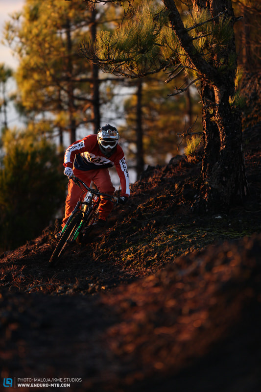
Jungle in the East, stony desert in the West.
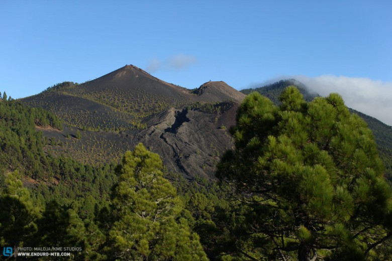
A few years ago I spent time travelling around Ecuador. While I loved the country, we spent a lot of time in the car in order to reach different trails, which were remarkably similar to the ones on this island – aside from the desert heat of 45°C (110°F)! Jungles and rocky cliffs in the North, high mountain summits over 2,000 metres, cacti and palm trees in the centre of the island, dry volcanic sandy deserts in the South – and all encircled by the sea, boasting temperatures of 20°C (70°F) plus even in November.
But where does such varied terrain come from? Well, the island is comprised of two parts: the south emerged much later due to volcanic activity from the sea and is therefore comparatively young and characterized by black volcanic lava sand. The northern part is significantly older and has had far more time to develop. The island looks a little like a compass arrow pointing south into the sea; it’s thirty km wide and sixty km in length. Its highest point is the Roque de los Muchachos, at 2,485 metres above sea level.
The north is pretty steep and less densely populated. The Roque isn’t the only volcano – given the many eruptions, the +/ 2,000 metrehigh Cumbre ridge was formed, which now splits the East and West. The ridge acts as a barrier to the weather as well, leaving the poor East to suffer the northeast trade winds and lose the sun around 5 PM behind the mountains. But bad weather is easily avoided, and it does mean the island gets sufficient water compared to the other Canary Islands.
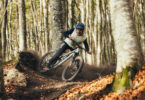
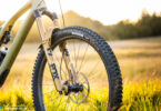
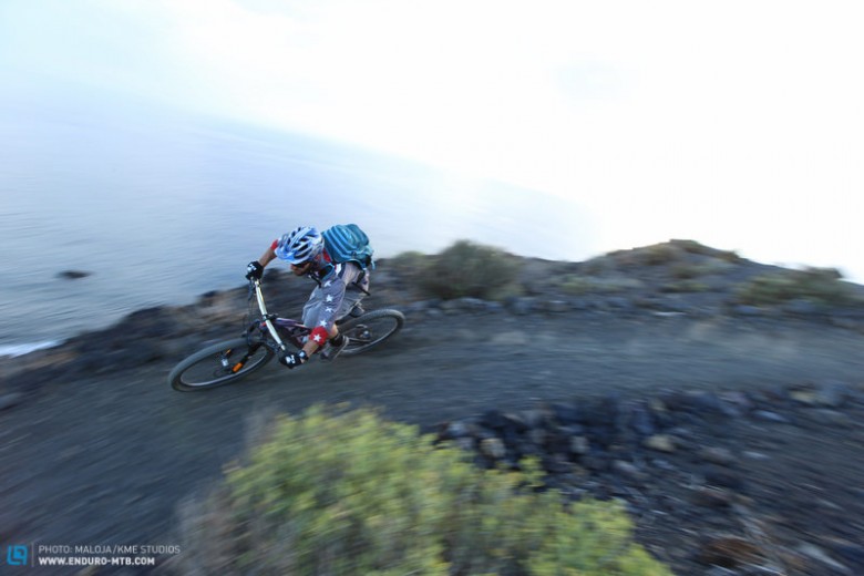
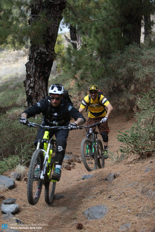
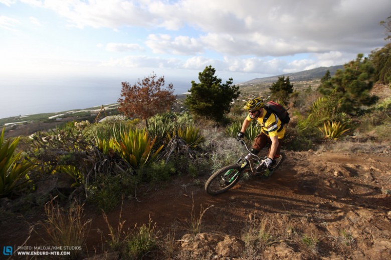
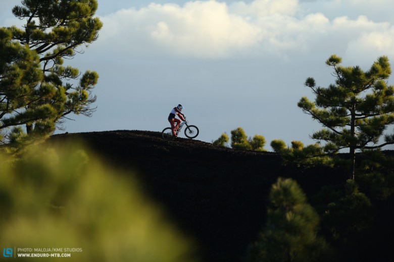
In short, the whole island is basically a mountain, with descents in every single direction. Steep, sandy, swooping pine tree forests, boulderstrewn – there’s a bit of everything. When road riders ask me about the island, I tell them they’ll have ridden it all within three days. For mountain bikers, however, it’s a different story entirely; even after fifteen years I’m still discovering new parts. Seven or eight years ago, some locals introduced me to these jungle-like trails in the north towards Punta Llana, which spurred Bikestations on to provide shuttles to the north. Now there are five or six trails that cover at least 1,500 metres of elevation.
In the central part and the sandcovered south of the island, there are countless trails to ride. Starting from the Alpine trails at the highest point, you can ride many variations along the ridge heading directly down to your front door. The ridge, the ‘Cumbre,’ doesn’t just divide the East and West, but also the North and South on the West side. The enormous crater edges are home to La Palma’s most wellknown trail that skirts the edge, dropping from 2,485 metres right down to zero. From the summit, you head through volcanic stones, pine forests, and vineyards, accompanied by amazing views over the entire western Aridane Valley across to the sea.
Temperature drops of 25° aren’t uncommon on this stretch, but usually it’s around a 10° drop – although editor Christoph experienced an extreme change of 35°!
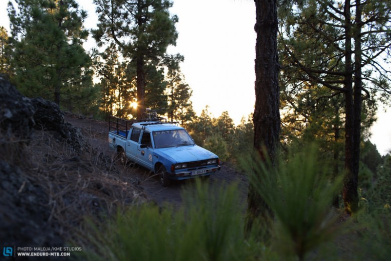
Given these conditions, the whole island is rideable, never failing to offer new routes. With some experience, you’ll know exactly where to find the good weather on any given day, chasing the sun across the island. The diverse vegetation means the trails are also massively diverse, and a shuttle can take you to them all with an hour and a half. Shorter rides are possible too, such as on the homemade trails that are springing up more and more, and these can easily be looped to create a great day of riding.
Daniel’s top five trails on the island
Trail 1: Roque de los Muchachos Tazacorte.
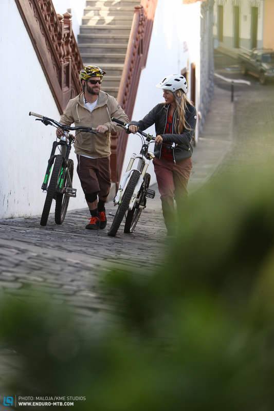
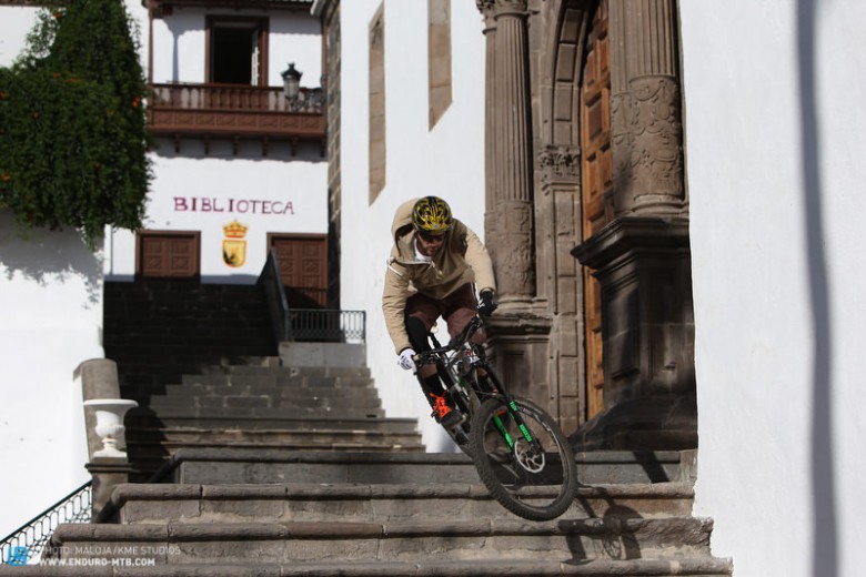
Probably the Canary Island’s bestknown trail, this isn’t an easy one. Starting high above the island, it’s immediately rough and rocky. Descending towards the west, it keeps getting better and better. The impressive and rugged volcanic landscape gives way to swooping forest tracks which demand your attention as they constantly set new technical challenges. Further down into the terraced vineyards, you’ll roll back into civilization. Ancient cobbled paths and bridleways lead you down to the sea, with an amazing concoction of toughness, views, photo opportunities, and flow. High chance of exhaustion and sunburn!
TIP: If you prefer a bit more of a mellow ride, take the trail that starts from the helipad at the observatory on Roque de los Muchachos. This rides parallel to the ridge and avoids the tougher mountain sections. But you do still have plenty of uphills, making it the ideal enduro experience.
Trail 2: Pico de la Nieve Reventon
The most impressive island trail, this one heads from the Cumbre towards the south. There are many uphills, with a few sections to push up if you’re less used to climbing. This trail is amazing because it stays on the ridge and treats you to incredible views over both sides of the island, first over the giant volcanic crater of Caldera and then over towards Tenerife and America. Technically not too demanding, but with its numerous climbs, it’s still not easy. In the first two hours you won’t lose much elevation, but after that it easily becomes the island’s most flowing trail. The ground is almost claylike, and you swoop along the corners on the ridge until you reach the Reventon Pass. At around 1,500 metres above sea level, this is most likely the oldest trade route between East and West. From here you can descend towards the capital of Santa Cruz (East) or Los Llanos (West), depending on the time and where you’re staying.
Trail 3: Deceada Faro de Fuencalliente
Right in the south, this is a route that starts with some climbing. The best option is to start on the west side at the former incinerating plant, signposted Pirs. From there, head up to Ruta de los Volcanes. But watch out – mountain bikers aren’t allowed to ride higher than 1,800 metres above sea level on this part. Once there, enjoy the lava sand descent, which you’ll never want to end. At times, the terrain is hardpacked too. There’s then a tough section of 34 km ahead before the fun pine forest trails take you down to Fuencalliente. The most southern spot on the island marks the ideal tapas stop before you ride through the youngest of the island’s volcanic regions. Visually spectacular, you’ll pass the Teneguia volcano (just forty years old!) before the sea and the lighthouse come into sight.
Tip: If you prefer not to climb so much, head up the east side from the Fuente de los Roques, which leads to a wide, gravelly lavastone path.
Trail 4: The Jungle
This trail starts from below the Pico de la Nieva car park, reached from a slightly higher gravel path that you can reach from the main road. But from here, it’s downhill all the way. From pine forests at the start, it’s steep at times, often slippery but always flowing. The hardpacked ground has tons of turns, and there are super highspeed sections that take you down to a natural waterway in the middle of a very dense rainforest. Watch out: the shrubbery that lines the path is more aggressive than it looks, and has ripped many jerseys over the years. Keep going until Punta Llano, where civilization awaits. The petrol station is a good tip for a refreshment stop.
After two hours of descending, it’s time to go back uphill and take the same trailhead, but in the direction of Santa Cruz. Or, for those staying on the west side, take a shuttle up to Cumbre and follow one of its countless trails to make the most of the day.
Trail 5: Quick Blast
Head up to Llano de las Brujas (‘The Plain of the Witches’) and skirt around the foot of Montana Enrique until you reach the trailhead of the Quemada trail.
Here you’ve got the choice between the Quemada trail across rough but flowing lava fields that take you to the tourist information centre above El Paso, or go for the super flowing stretch, which begins on the left a few metres further along the gravel path. Little jumps, tight corners, and diverse Gouts make this superfun to ride, and spit you out on the main road to El Paso/Santa Cruz. If you follow this up, you’ll reach a petrol station where you can have a snack, as well as find the info centre, from where you can shuttle up (if you want to save energy) and combine both trails into one day.
Travel tips:
Food:
Aside from Carnival, the island isn’t really a nightlife destination, but it does offer a lot when it comes to food. The El Secadero in la Manchas and the Bodage Tamanca in Jedey are two standout highlights! Fans of grilled meat should definitely pay a visit to Mar y Terra in Los Llanos and the stylish plaza.
Best time to travel:
The best times for riding holidays here are between November and April. La Palma presents dry trails and decent temperatures at exactly the same time when the rest of Europe leaves a lot to be desired.
Local guide:
If you’re after a local guide, have a look at Daniel’s website, Dansdesktop.com. He knows the island like no other and knows exactly what riders are after. It’s wise to book early to avoid disappointment.
Local bike shop:
If your rear hanger snaps or your tyres slash then Siggi’s Bikeshop is guaranteed to have the
solution. magicbikelapalma.com
Shuttles & accommodation:
Siggi is your man once again when it comes to shuttles & accommodation! He’s got plenty of
rooms in his B&B and shuttles available almost daily, with prices starting from 12 – 30 €. Both Condor and Airberlin have regular flights to La Palma, with inexpensive options to transport your bike too. If you’d prefer a direct flight, you might be restricted to certain days. From Munich, it’ll always be a Tuesday.
Words: Daniel Schäfer Photos: Maloja / KME Studios
Did you enjoy this article? If so, we would be stoked if you decide to support us with a monthly contribution. By becoming a supporter of ENDURO, you will help secure a sustainable future for high-quality mountain bike journalism. Click here to learn more.