Transcatalan: How it all Started
Two Dutch guys from the city of Haarlem, with a passion for mountain biking, and who know the trails in the Pyrenees better than the locals themselves. How on earth is that possible, you may ask? Do these guys have a crystal ball that shows them all the exceptional trails in a certain area or did this trail originate some other way? The secret lies in two simple words: passion, and dedication. Niels, the owner of a large furniture workshop, and Antoine, a happy-go-lucky, dreamy adventurer and endurance athlete, travelled to the Pyrenees no less than thirteen (!) times between July 2010 and August 2015 to trace this route.
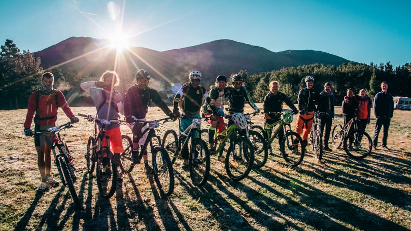
The initial idea was to cross an entire mountain range. They had set their eyes on the Pyrenees, a range they wanted to cross from the Mediterranean in the east to the Atlantic in the west. Not a terribly original idea in itself, but Niels and Antoine had an extra requirement. While ascending double tracks could be used, but going down only GR hiking trails were allowed. Having visited travel shop ‘Pied à Terre’ in Amsterdam Antoine drew the original route on the map. In the summer of 2010, with a group of six and a support crew of three, they set forth from Banyuls-sur-Mer to arrive in Hendaye eleven days later. Yes, they had done it. Yes, it had been a rad adventure. But how hard it had been! No way this could be done by ordinary folk.
Based on this trial run they adapted the concept and formulated six requirements for future Transcatalan trips:
- No shotter descents (double tracks, fire roads, 4×4 tracks)
- No more than 50 kilometres a day
- Just one uplift a day, and no longer than 30 minutes
- More descending than ascending
- Two hours climbing max
- Start high, finish at sea level
After that many more route finding trips were made, all on trial and error basis. A normal day looked like this: hitting the trail, searching, searching, finding, rejecting, walking, crashing, grumbling, paying a visit to bike repair guy, hitting the trail again with mended bikes, searching, clearing the trail, looking for that final connection to be able to exit the valley… and finding the ideal solution! After a while the route began to take shape, on the map at least. The route was finalized and Antoine presented it to the official bodies to get their approval. Two months later the official response came: no can do. Wait, what? The main reason was that the route crossed too many nature reserves. Sixteen changes needed to be made. Some problematic stretches measured only a couple of hundred yards. That by itself wasn’t too much of a problem – just the fact that there was a deep ravine on either side! An extra year of scouting ensued. The tracks in Spain were cut, which immediately eliminated six banned stretches. In 2015 the final route was established and approved from beginning to end. From that moment onwards all attention could be directed to the organizing of a trial week with friends and certain media. Which is the reason why you’re reading this article.